

New Zealand South Island Road Trip: A 14-Day Loop from Christchurch
Glaciers, fjords, rainforest and desert basins packed into an island the size of England — connected by two-lane roads that are slower than any map estimate.
The South Island is roughly the size of England and contains glaciers, fjords, temperate rainforest and dry desert basins within a few hours of each other — which is exactly why a new zealand south island itinerary built on mapping estimates collapses by the end of the first week. The roads between all of it are two-lane, winding, and slower than any app will tell you. Here is the single change that improves most South Island plans: do not do Milford Sound as a day trip from Queenstown. That is roughly 12 hours of driving and boating for a 2-hour cruise. Sleep in Te Anau the night before and the same day becomes comfortable. The loop below runs Christchurch → Lake Tekapo → Aoraki/Mount Cook → Wānaka → Queenstown → Te Anau → Milford → the West Coast glaciers → Arthur's Pass → Christchurch, roughly 2,000 km (1,240 mi) over 14 days, with an honest drive time on every leg.
Driving in New Zealand: The Briefing That Prevents Crashes
Crashes involving overseas drivers are a recognised problem on these roads, and the causes are boringly consistent: unfamiliar side of the road, mountain curvature, fatigue, and speed chosen from the sign rather than the conditions. Read this section before you collect the car, not after.
One-lane bridges are common across the South Island and relentless on the West Coast, where the Day 11 and Day 13 legs cross dozens of them. Each one carries a sign with two arrows, and the sign is read by size:
- Larger red arrowYou give way. The red arrow points against you, oncoming traffic has priority, and you stop before the bridge and wait.
- Larger black arrowYou have priority. The smaller red arrow is the one facing the other side. Proceed — but still look, because the driver coming the other way may be a visitor who has not read this.
The shortcut that genuinely works: bigger arrow wins, and if the bigger arrow is red it is not yours. Slow right down on approach regardless, because some of these bridges are shared with rail, some are on blind curves, and some are long enough that you cannot see the far end when you commit.
This is the rule that makes a South Island itinerary survive contact with the actual roads. Mapping tools assume an average speed these roads do not deliver: single carriageway almost everywhere, constant curvature, mountain passes, slow vehicles with nowhere to pass them, and limits that drop sharply through every settlement. Add photo stops — and you will, because the scenery is the point — and a stated 4-hour leg becomes a 6-hour day. The drive times in the day cards below are realistic moving times rather than optimistic ones, but apply the 1.5× multiplier to anything you add to this plan.
Keep left, and the driver sits on the right
New Zealand drives on the left. The wipers and indicators are usually reversed from what a US driver expects, which is how you identify a nervous visitor at every intersection. Give yourself the first hour somewhere flat and quiet rather than on a pass.
Give way to the right, and roundabouts run clockwise
At roundabouts, traffic circulates clockwise and you give way to vehicles already on the roundabout, approaching from your right. Signal left as you exit. At uncontrolled intersections the general rule is to give way to the right. And there is no turning on a red light anywhere in New Zealand — a reflex worth consciously suppressing.
100 km/h is a maximum, not a target
The open-road limit is generally 100 km/h (about 62 mph), and large stretches of this loop cannot be safely driven at it. Posted advisory speeds on corners are there because the corner tightens. Locals will sit closer behind you than you are used to; the answer is to use the next pull-over bay, not to speed up.
Passing lanes are infrequent — use them
Overtaking opportunities on two-lane mountain roads are rare and signposted well in advance. Use the passing lanes rather than attempting a pass on a blind curve, and pull over to let faster local traffic through. A queue of three cars behind you is the social signal to use the next bay.
Gravel roads are usually excluded by your rental contract
Many scenic side roads are unsealed, and most New Zealand rental agreements restrict or prohibit driving on them — with damage sustained there typically excluded from the insurance you paid for, whatever excess product you bought. Read the specific clause before you sign. If your plan needs gravel, ask at the counter which operators allow it and on what terms.
Fuel gaps are real on this loop
There is no fuel between Te Anau and Milford Sound, and the Haast Pass and West Coast legs have long gaps between stations with limited opening hours. Fill the tank in Te Anau, Wānaka, Haast and Hokitika rather than running down to a quarter and hoping.
The classic accident combination is a 15-hour flight, a first attempt at left-hand driving, and a mountain road, all on the same afternoon. That is why this itinerary gives Christchurch two nights with no long leg. If your flight lands late, consider a shuttle to a hotel and collecting the car the next morning instead.
The 14-Day Loop, Day by Day
Distances are approximate driving distances in both units; the drive time beside them is a realistic moving time for New Zealand roads and excludes stops. Build your day around the drive time, not the distance. Anything marked with a tilde is rounded. Remember the seasons invert: December through February is high summer here, June through August is deep winter.
Christchurch
Two nights before you commit to any real distance, because the flight into Christchurch from North America is long enough that your first driving day should be short. The Botanic Gardens and the Avon loop fill a jet-lagged morning. The Transitional Cathedral — the cardboard one, built after the 2011 earthquake — is a fifteen-minute walk from the centre and worth the detour. Day two, run out to Banks Peninsula and Akaroa, a drowned volcanic harbour roughly 80 km (50 mi) away on a road of tight switchbacks that is a useful, low-stakes rehearsal for everything that follows.
→ Lake Tekapo
Out across the Canterbury Plains and up into the Mackenzie Basin, where the landscape switches abruptly from farmland to high dry tussock country ringed by mountains. The lake is a glacial-flour turquoise that photographs as though it has been edited. The Church of the Good Shepherd on the shore is the most photographed building in the country, so go at dawn or wait out the coaches. Then stay up: Tekapo sits inside the Aoraki Mackenzie International Dark Sky Reserve, and the Mount John summit road above town is where the stargazing happens.
→ Aoraki/Mount Cook Village
Short in distance, and one of the great drives anywhere: the road runs the full length of Lake Pukaki with Aoraki/Mount Cook standing at the head of it, growing the whole way in. Two nights, because the mountain is cloud-covered often enough that one night is a coin flip. The Hooker Valley Track is the reason you came — roughly 10 km (6.2 mi) return, mostly flat, three swing bridges, ending at a glacial lake with icebergs in it beneath the country's highest peak. The Tasman Glacier viewpoint is a short climb on the other side of the valley.
→ Wānaka via the Lindis Pass
Back down Lake Pukaki and over the Lindis Pass, a high golden tussock saddle that looks like nowhere else on the island. Wānaka is the quieter lake town, and it is where the loop gets its best value. Roys Peak is the famous one — roughly 16 km (10 mi) return and relentlessly steep, typically a five-to-six-hour commitment with no shade, so start early. The Wānaka tree is five minutes from town, and the Rob Roy Glacier track up the Matukituki Valley is the better walk if your legs are already spent.
→ Queenstown via the Crown Range
The Crown Range Road is the highest sealed road in New Zealand and a genuinely steep set of switchbacks on the Queenstown side — it is spectacular, and in winter it can require chains or close entirely, in which case the longer valley route via Cromwell is the alternative. Queenstown itself is the adventure hub and the most expensive town on the loop. The Skyline gondola gives you the Lake Wakatipu view without a hike, Arrowtown is a twenty-minute drive of restored gold-rush streets, and the Gibbston Valley wineries are close enough that someone has to stay sober.
→ Te Anau
The single most important line in this itinerary: you sleep here, not in Queenstown. Te Anau sits on the edge of Fiordland on the shore of the country's second-largest lake, and it exists in this plan purely so that tomorrow morning's Milford cruise is a two-hour drive rather than a four-hour one. Arrive with enough daylight to fill the fuel tank, buy insect repellent if you have not already, and check the Milford Road status before you go to bed.
→ Milford Sound and back
Leave early for a morning cruise, which is generally calmer and less crowded than midday. The road itself is the first half of the experience: Mirror Lakes, the beech forest of the Eglinton Valley, Monkey Creek, the one-way Homer Tunnel bored straight through the Darran Mountains, and the short walk into the Chasm below it. Budget real time for stops — this is a road where the 2-hour drive becomes 3 hours and should. Back to Te Anau for a second night, or push on toward Queenstown if your Day 11 start demands it.
→ Fox or Franz Josef via Haast Pass
The long day. Start early and mean it. North past Wānaka, over the Haast Pass through beech forest and waterfalls, then out to the wild, driftwood-strewn West Coast at Haast and up the coast road to glacier country. The Blue Pools near Makarora are a short walk off the highway and the right place to break the drive. From Haast north the one-lane bridges begin in earnest — this is the leg where the red-arrow rule stops being theoretical.
Glacier country
A day without a long drive, which after yesterday is the point. Both Franz Josef and Fox have valley walks to a terminal-face viewpoint, though the glaciers have retreated substantially and the viewpoints are further from the ice than older photographs suggest. Lake Matheson, near Fox, is the quiet highlight: a flat loop around a tannin-dark lake that on a still dawn reflects Aoraki/Mount Cook and Mount Tasman together. Still is the operative word — go at first light, before any wind.
→ Arthur's Pass via Hokitika
North up the coast through Hokitika — the gorge there is a short detour to improbably blue water and a swing bridge — then inland and up into Arthur's Pass, the central alpine crossing and a national park in its own right. Devils Punchbowl Falls is a steep but short walk from the village. Keep food out of reach and your car closed: the kea here are alpine parrots with a documented talent for dismantling rubber trim.
→ Christchurch
Down the eastern side of the pass through Castle Hill, a basin of enormous weathered limestone boulders that is a five-minute walk from the car park and the best final stop on the loop. Then the Waimakariri valley back onto the plains and into Christchurch. If you are flying out, build in a buffer: this is the day a late start and one more photo stop turns into a missed check-in.
Fourteen days, 2,000 km and a dozen drive times that mapping tools underestimate. TripsGalaxy.com builds this exact loop with realistic stop spacing and opens it in Google Maps.
Try it freeOne sequencing note. The loop runs anticlockwise here for a reason: it puts the two Mount Cook nights early, while you are still fresh, and it front-loads the short-distance days so that the 400 km (250 mi) Haast Pass leg on Day 11 arrives once you are fully acclimatised to left-hand driving on mountain roads. Run it the other way and that leg lands in your first week.
Find hotels in QueenstownMilford Sound: Why You Should Sleep in Te Anau
This is the argument that most South Island itineraries get wrong, and it is settled entirely by arithmetic rather than opinion.
Roughly 290 km (180 mi) each way, and about 4 hours each way once you account for the stops the road deserves. That is roughly 8 hours in a vehicle plus a 2-hour cruise plus boarding time — a 12-hour day, much of it spent getting to and from a fjord you see for two hours. Coach day trips frequently leave Queenstown before dawn for exactly this reason.
Roughly 120 km (75 mi) and about 2 hours, which makes an early morning cruise comfortable rather than brutal. You leave after breakfast instead of in the dark, you have time for Mirror Lakes and the Chasm, and you are back for dinner. One extra night converts the worst day of the trip into one of the best.
The Milford Road (State Highway 94) runs through genuine avalanche terrain, and the avalanche season typically runs from around June to November — the southern winter and spring. NZTA Waka Kotahi reports the road is closed on roughly eight days in an average year, mainly in winter, when weather and avalanche risk make it unsafe, and the road is also closed for controlled avalanche release using explosives. Through that season vehicles may be required to carry snow chains, with road-condition signs north of Te Anau, at Knobs Flat and east of Milford Sound Piopiotahi telling you when; driving past a sign that requires chains can carry a police fine. Stopping inside the avalanche zone may also be prohibited. Check the NZTA road status the night before and again in the morning, and do not plan a non-refundable cruise around a single winter date.
There is no fuel between Te Anau and Milford
None at all on the roughly 120 km (75 mi) of road, and none at Milford Sound that you should count on. Fill the tank in Te Anau before you leave. The same applies to food, drinking water and mobile coverage, which is patchy to absent for most of the drive.
Take the morning cruise
Morning sailings are generally calmer and less crowded than midday, because the coach day trips from Queenstown cannot physically reach Milford until late morning. That gap is the entire practical advantage of sleeping in Te Anau, and it is why the fix works.
The drive is half the attraction, so budget for it
Mirror Lakes, the Eglinton Valley flats, Monkey Creek, the Homer Tunnel and the short walk into the Chasm are all worth stopping for. The 2-hour drive is a 3-hour morning if you do it properly — which is another way of saying the Queenstown version does not let you do it properly.
One last reframe. Milford is one of the wettest inhabited places in the country, and a rainy forecast is not the disaster it looks like — heavy rain multiplies the temporary waterfalls pouring off the cliffs into the fjord, and many people who have seen it both ways prefer the wet version. A grey, streaming Milford is still a very good Milford. Bring a shell, not a cancellation.
Browse Milford Sound cruisesDay Hikes Ranked by Payoff per Effort
Ranked by what you get for what you spend, not by how famous the photograph is. Times are typical walking times at an unhurried pace and will stretch if you stop, which on all of these you will.
| # | Walk | Distance | Time | Difficulty | Payoff |
|---|---|---|---|---|---|
| 1 | Hooker Valley Track | ~10 km (6.2 mi) return | Typically 3 to 4 h | Easy — mostly flat, well formed | The best scenery-to-effort ratio in the country. Three swing bridges, a glacial lake with icebergs in it, and Aoraki/Mount Cook head-on the whole way. Almost everyone can do it. |
| 2 | Lake Matheson loop | ~4 km (2.5 mi) loop | Typically 1 to 1.5 h | Easy — flat, largely boardwalk | Aoraki/Mount Cook and Mount Tasman mirrored in dark, still water. Entirely dependent on wind — go at dawn or do not bother. |
| 3 | Key Summit (Routeburn) | ~7 km (4.3 mi) return | Typically 3 h | Moderate — steady climb, then flat | A day-walk sample of a Great Walk, taken from the Divide on the Milford Road. An alpine bog plateau with three valleys falling away from it. No hut booking required for the day section. |
| 4 | Blue Pools, Haast Pass | ~1.5 km (0.9 mi) return | Typically 1 h | Very easy — boardwalk and swing bridge | Startlingly clear glacial-fed pools, reached in minutes. The right way to break the long Day 11 drive rather than driving it straight through. |
| 5 | Devils Punchbowl Falls | ~2 km (1.2 mi) return | Typically 1 h | Moderate — short but many steps | A tall waterfall a few minutes from Arthur's Pass village. Steep stairs condensed into a short distance, which makes it feel harder than the numbers. |
| 6 | Roys Peak | ~16 km (10 mi) return | Typically 5 to 6 h | Hard — relentless, exposed climb | The famous ridgeline photograph over Lake Wānaka. Ranked last not because the view is worse but because the effort is enormous and there is no shade — which, given New Zealand's UV, is a real consideration rather than a complaint. |
Everything in the table above is a day walk that needs no booking. The multi-day Great Walks — the Milford Track, the Routeburn and the Kepler, all within reach of this loop — are a different undertaking entirely. The Department of Conservation releases hut and campsite bookings for the coming season several months in advance, with each track opening on its own date; for the 2026/27 season, bookings opened across May 2026 for stays running from July 2026 through June 2027, and DOC now runs a virtual queue to handle the demand. The Milford Track is reported to have sold out in well under an hour. If a Great Walk is the reason for your trip, the release date is the date you plan the whole trip around — check doc.govt.nz for the current season's opening dates, because they shift year to year. This guide covers the day walks; serious trampers should plan from DOC directly.
A note on ranking Roys Peak last. The view is genuinely one of the best on the island. But it is a steep, fully exposed climb of roughly 16 km (10 mi) return that typically eats five to six hours and most of the next day's legs — and the Hooker Valley gives you a comparable calibre of scenery for a third of the output. If you only have the energy for one big walk on this loop, the Hooker is the better purchase.
Shop hiking poles and trail gear at REISandflies, Alpine Weather and the Four-Seasons Day
The honest-discomfort section. None of this ruins a South Island trip, but all of it surprises people who arrived expecting a temperate island holiday.
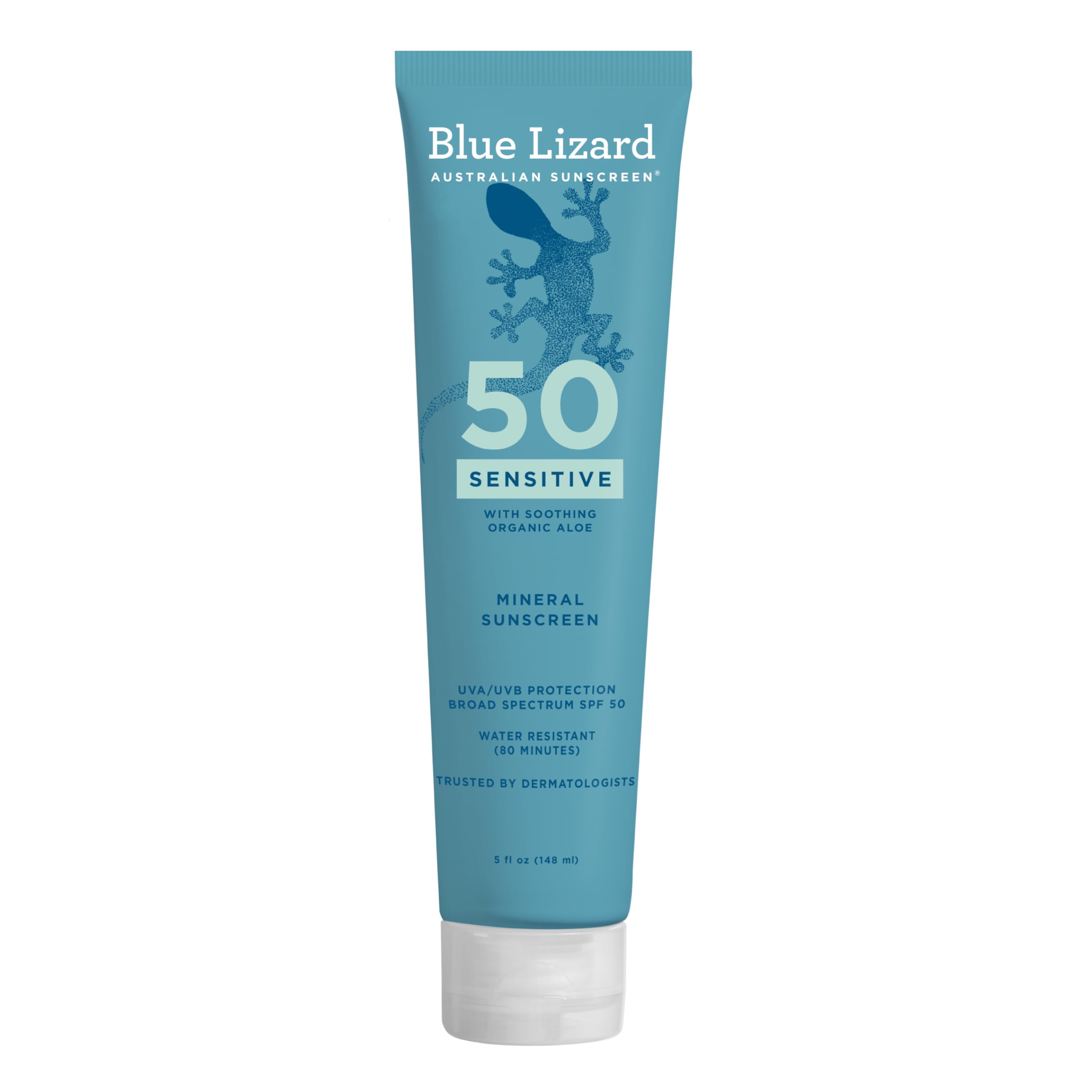
This catches visitors more reliably than anything else on the island. New Zealand's peak summer UV is substantially stronger than at comparable latitudes in the northern hemisphere — a combination of seasonal ozone thinning over the Southern Hemisphere, very clean air with little pollution haze, and the Earth being closer to the sun during the southern summer. Burn times in the December-to-February peak are genuinely short, and altitude on the alpine walks makes it worse again. The trap is temperature: it can be 16 °C (about 61 °F) with a cool breeze on the Hooker Valley Track while you are burning. Treat sunscreen, a brimmed hat and sunglasses as compulsory on every exposed walk here — Roys Peak and the Hooker Valley especially — regardless of how cold it feels or how overcast the sky looks.
New Zealand's UV is among the world's most intense. Cool air and a fast burn is the usual surprise.
Sandflies are a genuine nuisance, not a travel-blog exaggeration
On the West Coast and throughout Fiordland, sandflies are relentless — Milford and Te Anau are the notorious ones, and the moment you stop walking they find you. The practical answer is repellent containing DEET or picaridin, applied before you get out of the car rather than after the first bite, plus covered ankles and long sleeves at dawn and dusk. The bites itch for days. Buy repellent in Te Anau or Queenstown if you did not pack it.
Alpine weather changes fast, in any month
Snow on the passes is possible in any month of the year. The Milford Road, Arthur's Pass, the Lindis Pass and the Crown Range can all close or require chains, sometimes at short notice. The four-seasons-in-one-day cliché is a cliché because it is accurate: carry a waterproof shell and warm layers on every walk, even a short one on a clear morning, and check the forecast and road status the same day rather than the night before.
Rivers rise quickly after rain — do not cross a swollen one
Heavy rain on the West Coast and in Fiordland turns benign stream crossings into dangerous ones within hours, and river crossings are a recognised cause of tramping fatalities in New Zealand. If a river is higher, faster or browner than you expected, turn back and wait. They usually drop as quickly as they rose. This is one of the few places on this page where the advice is simply: do not.
Tell someone your plans in the backcountry
Mobile coverage is absent across most of Fiordland, the Haast Pass and much of Arthur's Pass. For anything beyond a signposted day walk, leave your intentions with someone, consider a personal locator beacon — they are rentable in most gateway towns — and download offline maps for the whole loop before you leave Christchurch.
Where to Base: The Towns That Anchor the Loop
Seven bases across fourteen days. The order you book them in matters more than which ones you pick — most people book Christchurch first because it is the arrival city, and that is exactly backwards.
Mount Cook Village
Book this one FIRSTThe constraint that governs the whole loop. The village is inside a national park and has a very short list of beds — a lodge, a hotel, a hostel, a campground, and little else. It sells out far ahead in the southern summer and prices accordingly. Fix these two nights before anything else, then build the rest around them. Twizel, roughly an hour away, is the standard fallback with far more supply.
Te Anau
Best for Milford — the fixThe whole argument of this guide in one booking. Te Anau to Milford is roughly 2 hours; Queenstown to Milford is roughly 4. One night here converts a punishing day trip into a comfortable morning cruise.
Wānaka
Best value, and the counterintuitive pickTrade two of your Queenstown nights for Wānaka. It is roughly an hour away over the Crown Range, reaches much of the same scenery, is meaningfully cheaper, and is a far calmer town to come back to after a day on a mountain.
Lake Tekapo
Best for dark skiesSmall, and it books out in summer on the strength of the Dark Sky Reserve alone. Twizel and Lake Pukaki have overflow options if Tekapo is gone.
Queenstown
Best for activities — and the most expensiveThe widest choice of beds, food and operators on the island, and the price tag that goes with being the adventure capital. Two nights is plenty for this loop.
Christchurch
Best for arrival and departurePlenty of supply, easy to book late, and the only place on the loop where your dates can move a day without consequence. Book it last.
Franz Josef or Fox
Best for glacier accessTwo small glacier towns roughly 25 km (16 mi) apart. Franz Josef has more beds and more restaurants; Fox is quieter and closer to Lake Matheson. Either works — pick on availability.
The counterintuitive one, stated plainly: swap two of your Queenstown nights for Wānaka. It is roughly an hour away over the Crown Range, it reaches much of the same alpine scenery, it costs meaningfully less, and it is a far more pleasant town to return to at the end of a long day. Keep a night or two in Queenstown for the gondola and the Gibbston wineries if you want them — but there is no requirement to sleep there for four.
Find hotels in Te AnauThe entire plan reduces to a booking order. Mount Cook Village accommodation first, and Great Walk huts first if you want one, because those are the two things on this loop that genuinely run out rather than simply getting expensive — and DOC's hut release date can land the better part of a year before your trip. Then the Milford cruise, so that the Te Anau night has something to anchor to. Then everything else — flights, the rental car, Queenstown, Wānaka, the glacier towns, Christchurch — in whatever order suits you, because all of it has slack. Get those three in that sequence and the rest of the South Island bends to fit around them. Get them backwards and you will be driving the Milford Road at the wrong hour on the wrong day, which is precisely the outcome this guide exists to prevent.
Common Questions
How many days do you need for the South Island of New Zealand?+
Should you visit Milford Sound from Queenstown or Te Anau?+
How do one-lane bridges work in New Zealand?+
What is the best day hike on the South Island?+
Continue Reading

New Zealand North Island Itinerary: 10 Days
A 10-day New Zealand North Island road trip from Auckland to Wellington with Rotorua geothermal parks, the Tongariro Crossing shuttle rule and Māori culture.

Best Time to Visit New Zealand: Month by Month
When to visit New Zealand: month-by-month weather, the Christmas domestic shutdown, Great Walks and ski seasons, UV warnings and how much season changes prices.

NZ Great Walks: Choosing & Booking
New Zealand's Great Walks compared by length and difficulty, how the DOC hut booking window works, trailhead transport, gear and excellent alternatives.
See Your Trip Come to Life
MIZA AI instantly turns inspiration into a fully mapped, day-by-day itinerary. Here's a sneak peek.
New Zealand South Island: A 14-Day Loop from Christchurch
Morning Scenic Drive
09:00 AMLocal Coffee & Breakfast
10:30 AMViewpoint & Photography
11:45 AMHistoric Downtown
01:30 PMMorning Scenic Drive
09:00 AMLocal Coffee & Breakfast
10:30 AMViewpoint & Photography
11:45 AMHistoric Downtown
01:30 PMMorning Scenic Drive
09:00 AMLocal Coffee & Breakfast
10:30 AMViewpoint & Photography
11:45 AMHistoric Downtown
01:30 PMDriving the South Island?
TripsGalaxy.com builds your 14-day South Island loop with realistic drive times, trailheads and overnight towns, and opens it in Google Maps. Free.
Plan This Trip →